The Living History of Clark Fork: From Timber and Mining Camps to Incorporated City

1927 - USCOE map of the Clark Fork area. The road (HWY 3) used to come across the river, turn on 1st Ave, run up Main St to 9th Ave, then over Lightning Creek, where the current city waterline is on top of the old footings.
Welcome to the digital archive of the
City of Clark Fork, Idaho

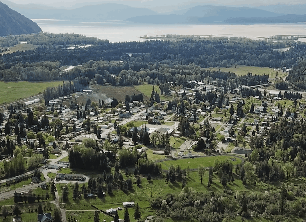
Nestled along the rugged banks of the Clark Fork River and cradled by the majestic Cabinet Mountains, our community has always been defined by its grit, natural beauty, and an enduring independent spirit. For generations, this valley thrived as a vital hub for pioneers, railroad workers, and timber crews. By the dawn of the 20th century, the growing settlement required a formal framework to build roads, establish order, and guide its bright future. On May 11, 1911, that vision became a reality when the very foundation of our municipal identity was laid with the signing of Ordinances 1-4 (Creation of Boundaries, Seal, Officers, & Meeting Place), officially forming the village we know today.As you explore the public documents below, you are stepping into a time capsule that charts the literal transformation of a wild Idaho border town into a modern municipality. The earliest records from the 1910s and 1920s tell a colorful story of an era when the town council had to pass laws against vagrancy, public brawling, and concealed weapons, while establishing curfews for minors and managing livestock with the city's first animal control laws. You will see the physical town take shape as the council mandated transitioning away from muddy paths to establish formal wooden sidewalk construction guidelines, and eventually, in 1926, passed our very first speed limits to regulate the newfangled automobile traffic on village streets. These early archives even capture the social climate of the time, documenting the short-lived 1912 ordinances banning intoxicating liquors and houses of prostitution just as national prohibition movements were gaining steam. As the decades rolled on, the "growing pains" of Clark Fork shifted from maintaining basic law and order to constructing heavy infrastructure. The mid-century records preserve the introduction of early modern comforts—like the arrival of power companies, taxicab regulations, and the unique 1940s craze of licensing coin-operated amusement devices, punch boards, and card tables to help fund city initiatives. You will find the vital "paper trails" of our community's literal lifelines: the massive water system expansions of 1949, 1969, and the final generation-defining water project bonds of the late 1980s. These public utility records stand alongside the fascinating history of our emergency services, capturing the birth of our Volunteer Fire Department in 1958 and the Cold War-era Civil Defense planning. They even map out our geographic engagements, understanding the 1955 Potvin v. Chubbuck legal annexation dispute that rolled back our city borders, the later 1970s land sales of the old city dumpsite, and the evolving Area of City Impact (ACI) border agreements with Bonner County. Finally, this grand archive serves as the permanent record of our community’s collective voice and resilience. Preserved within these pages are the official municipal election ledgers dating back to 1975 (previous records are missing), recording the names of the neighbors, parents, and grandparents who stepped up to lead our local government. And, perhaps most powerfully, these documents capture Clark Fork’s historic relationship with nature. Through the raw, real-time emergency declarations passed during the severe Lightning Creek floods over the many decades up to current 2025, we see a permanent testament to the resiliency of our citizens and the swift actions taken by local leaders to defend our town against the roaring waters. Every ordinance and resolution below—whether active, replaced, or long-ago repealed—represents a choice that shaped our home. We invite you to dive into these scrolls of public record and discover the incredible, unbroken story of Clark Fork, Idaho. 

Part 1: The Historical Ordinances (1911–1994)

A Community Built to Last
From the wooden sidewalks of 1911 to the modern town we share today, Clark Fork’s story belongs to its people. This archive stands as a permanent tribute to the leaders who guided us, the voters who decided our path, and the resilient neighbors who built our home along the river. Thank you for exploring our history. If you have historical city documents, photographs, or stories you would like to share with the city archives, please contact City Hall.

Russell Schenck

Mayor

Thanks to help from technology through AI and Grok, we were able to put this page together.

City of Clark Fork Logo, Established 1911

Address:
P.O. Box 10
110 East 3rd Ave.
Clark Fork, Idaho 83811

CityClerk1@ClarkForkIdaho.gov
T: 208-266-1315

Hours:
8:00 am -1:00 pm  Monday-Friday
Closed all Federal Holidays

Have a comment you'd like to share?  A comment form can be picked up from the office. You may also contact the city to have one sent via mail or email.

Visit us on Facebook

Public Records Request Forms can be picked up from the office. You may also contact the city to have one sent via mail or email.